Technical Equipment
Georadar OKO-2
The operating principle of ground-penetrating radar (GPR) is based on emitting ultra-wideband nanosecond pulses, receiving signals reflected from the boundaries between media, stroboscopic processing of the received signals, and subsequently measuring the time intervals between the reflected pulses.
As the ground-penetrating radar moves across the surface of the investigated medium, a set of signals (radargram or profile) is displayed on the monitor screen. From this data, one can determine the thickness of the underlying (bedrock) layers, the location, depth, and extent of subsurface objects.
As the ground-penetrating radar moves across the surface of the investigated medium, a set of signals (radargram or profile) is displayed on the monitor screen. From this data, one can determine the thickness of the underlying (bedrock) layers, the location, depth, and extent of subsurface objects.
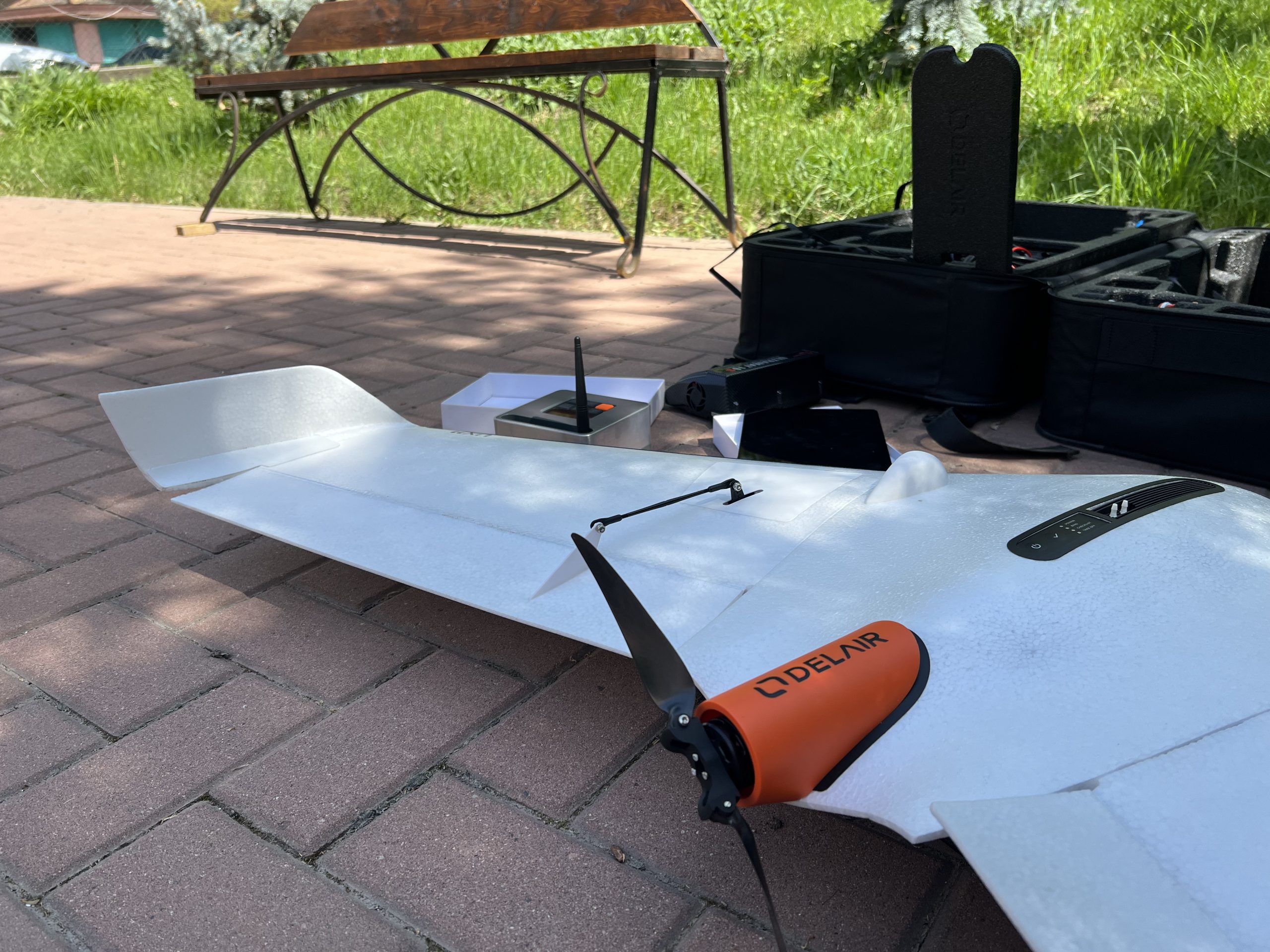
UAV Delair UX 11
The Delair UX11 is a professional fixed-wing unmanned aerial vehicle (UAV) designed for high-precision aerial photography and mapping of large areas. It is equipped with an industrial-grade RGB camera featuring a global shutter, a centimeter-accuracy GNSS receiver, and PPK processing support, which ensures the acquisition of highly accurate georeferenced data with a GSD resolution of up to ~1.7 cm. With a flight time of up to 59 minutes and coverage of 120–300 hectares per flight, the platform is effectively used in digital mapping, monitoring of inaccessible and mountainous terrains, as well as in the mining industry and engineering surveys.
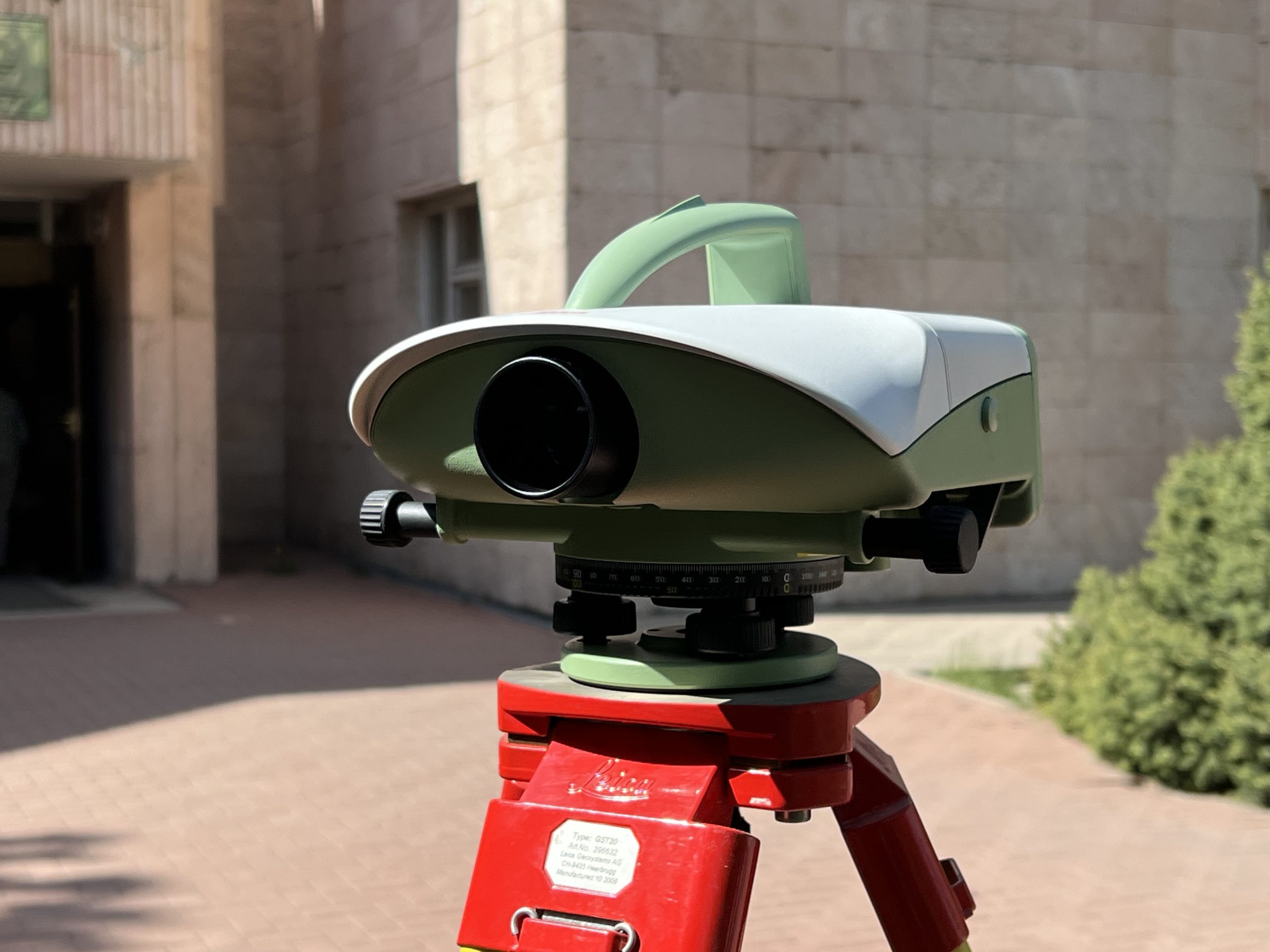
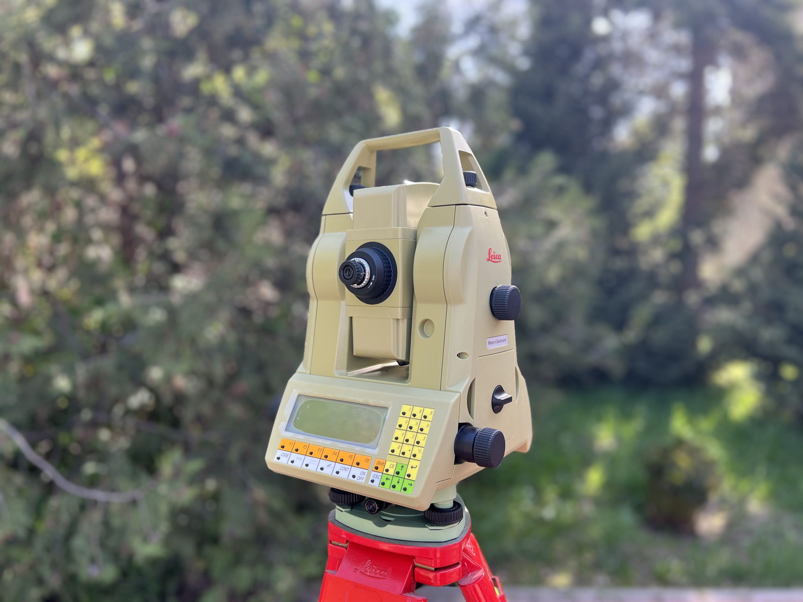
ТCA 2003 Electronic tacheometer
Spectra Precision SP90m GNSS receivers feature 480 communication channels and are compatible with satellite systems such as GPS, GLONASS, Galileo, BeiDou, QZSS, IRNSS, and SBAS. The modular design enables the receiver to be used as a field base station, a continuously operating reference station (CORS), an RTK or RTX rover, or integrated into vehicle onboard networks, among other applications.
Connecting two GNSS antennas allows the use of Spectra Precision SP90m geodetic receivers on vehicles. This enables precise determination of the vehicle’s direction of movement and speed.
DNA 03 Digital Level
The DNA03 electronic level by Leica is a precise and reliable instrument designed for the most demanding tasks that require high measurement accuracy.
The operation of the Leica DNA03 level is based on comparing the obtained measurement results with the reference data of the invar staff stored in the device’s memory. The automatic compensator improves the accuracy and reliability of measurements. A wide range of built-in programs enables the user to perform various tasks, such as reading the staff and determining distances, tying and untying traverse lines, automatically calculating height differences, and more. The Leica DNA03 digital level can operate both in electronic mode with invar staffs and in optical mode with standard leveling rods.
The operation of the Leica DNA03 level is based on comparing the obtained measurement results with the reference data of the invar staff stored in the device’s memory. The automatic compensator improves the accuracy and reliability of measurements. A wide range of built-in programs enables the user to perform various tasks, such as reading the staff and determining distances, tying and untying traverse lines, automatically calculating height differences, and more. The Leica DNA03 digital level can operate both in electronic mode with invar staffs and in optical mode with standard leveling rods.
Spectra Geospatial SP90m GNSS Receiver
Spectra Precision SP90m GNSS receivers have 480 communication channels and work with GPS, GLONASS, Galileo, BeiDou, QZSS, IRNSS, and SBAS satellite systems. The modular design allows the receiver to be used, for example, as a field base station, a continuously operating reference station (CORS), an RTK or RTX rover, integrated into vehicle onboard networks, and more. Connecting two GNSS antennas allows Spectra Precision SP90m geodetic receivers to be used on vehicles. This allows you to accurately determine the vehicle's direction and speed. The Spectra Precision SP90m GNSS receiver's built-in GSM modem allows for receiving corrections via a cellular channel. The modem can also be used to transmit vehicle position and speed data to a selected server for monitoring shipments or when tracking valuable cargo.
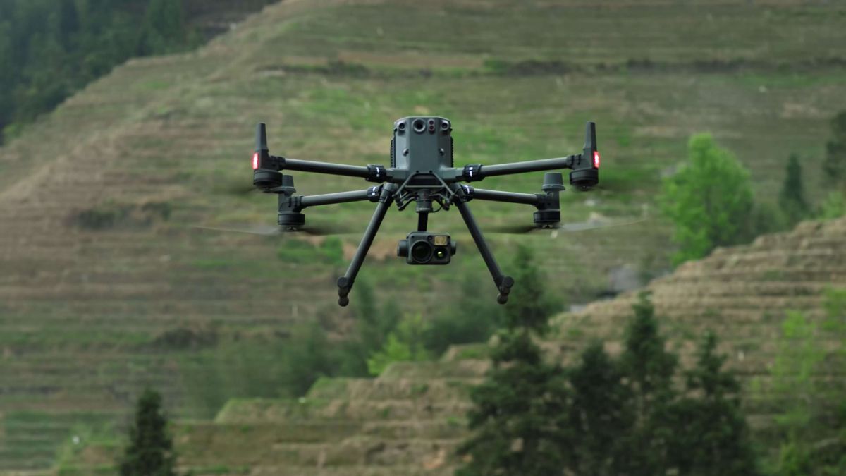
drone Matrice 350 RTK
The Matrice 350 RTK is a professional quadcopter by DJI, representing an advanced model in the Matrice series. It is designed to perform complex tasks in mapping, inspection, construction, agriculture, and other fields that demand high precision and reliability.
RTK (Real-Time Kinematic) is a technology that enables high-precision positioning (up to 1 cm) through the use of an external base station or correction network. This makes the Matrice 350 RTK ideal for mapping missions and other tasks that require highly accurate georeferenced data.
RTK (Real-Time Kinematic) is a technology that enables high-precision positioning (up to 1 cm) through the use of an external base station or correction network. This makes the Matrice 350 RTK ideal for mapping missions and other tasks that require highly accurate georeferenced data.
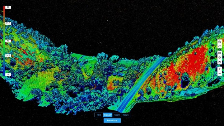
Lidar DJI Zenmuse L 1
The DJI Zenmuse L1 is a professional LiDAR sensor compatible with DJI's Matrice 300 RTK and Matrice 350 RTK drones. The Zenmuse L1 is designed for high-precision surveying using laser scanning to create 3D maps, models, and mapping data.
The system provides positioning accuracy of up to 2 cm using RTK (Real-Time Kinematic), allowing for the acquisition of highly accurate information about the Earth's surface. Measurement accuracy depends on the use of RTK and may vary depending on conditions, but with proper configuration, it delivers high-quality results.
The system provides positioning accuracy of up to 2 cm using RTK (Real-Time Kinematic), allowing for the acquisition of highly accurate information about the Earth's surface. Measurement accuracy depends on the use of RTK and may vary depending on conditions, but with proper configuration, it delivers high-quality results.
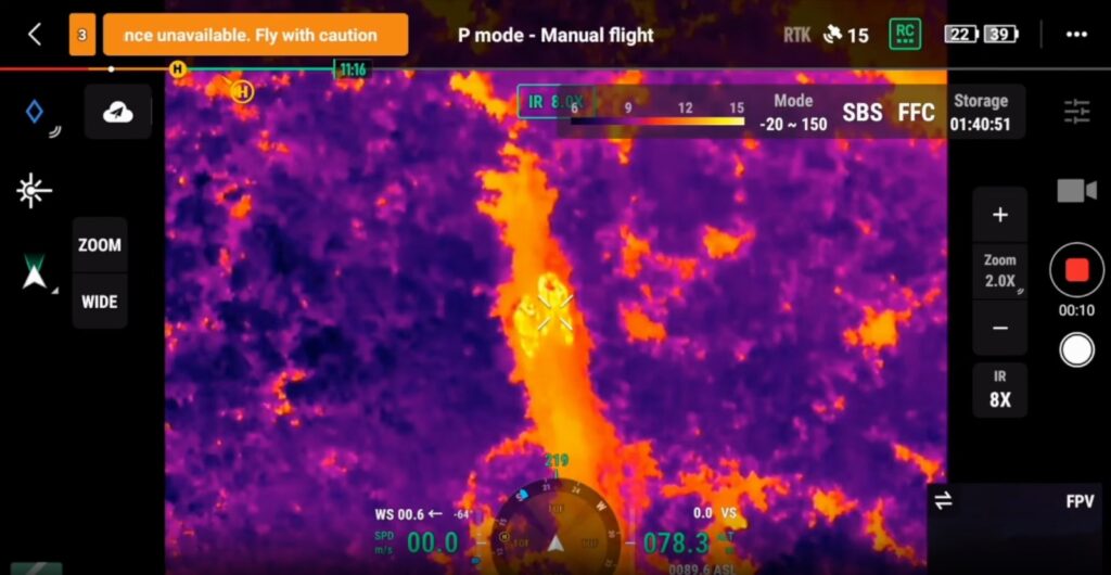
DJI Zenmuse H20N
The DJI Zenmuse H20N is used in aerospace monitoring and remote sensing projects for the rapid detection of thermal anomalies, infrastructure condition assessment, emergency surveillance, and other tasks. Thanks to its combination of thermal imaging, night vision, and zoom cameras, the system provides high-precision imagery day and night, making it particularly effective for monitoring natural hazards, mountainous terrains, and hard-to-reach areas using unmanned aerial systems.
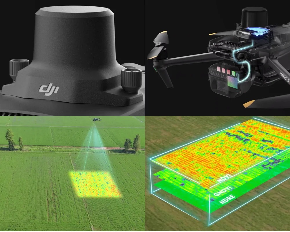
DJI Mavic 3 Multispectral
The DJI Mavic 3 Multispectral is used for high-precision monitoring of natural and agricultural areas using remote sensing technologies. The unmanned system is equipped with RGB and multispectral cameras, enabling the analysis of vegetation conditions, land degradation assessment, water body monitoring, and rapid terrain mapping. Based on the multispectral data, key vegetation indices such as NDVI, NDRE, and GNDVI are calculated to assess vegetation health, identify stress zones, and analyze ecosystem dynamics for environmental and agricultural monitoring.
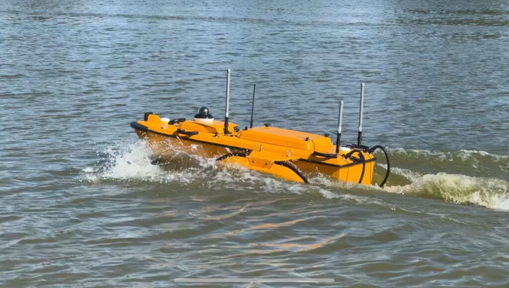
БПВА CHCNAV Apache 6 USV
It is used in hydrographic work to perform bathymetric surveys, which provide a detailed model of water body bottom topography based on depth measurements. The resulting bathymetric data are used to construct digital bottom models and subsequently calculate water volumes in rivers, lakes, and reservoirs, as well as to assess siltation and changes in reservoir capacity over time, which is essential for water management planning and the monitoring of natural and man-made objects.
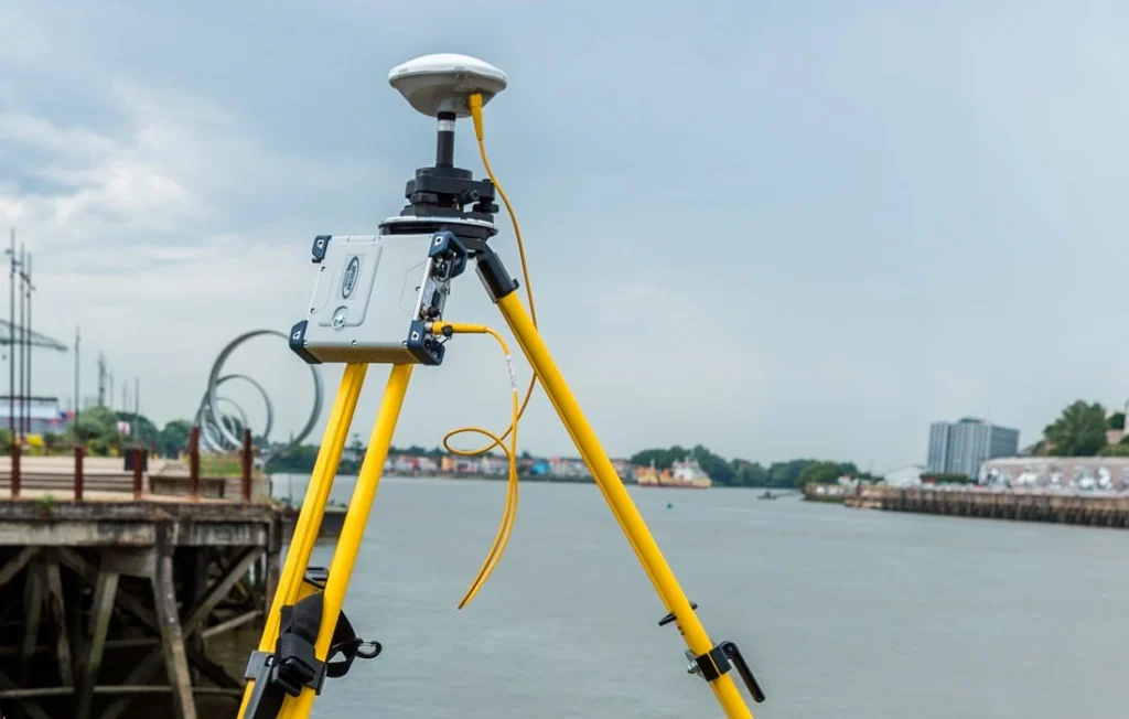
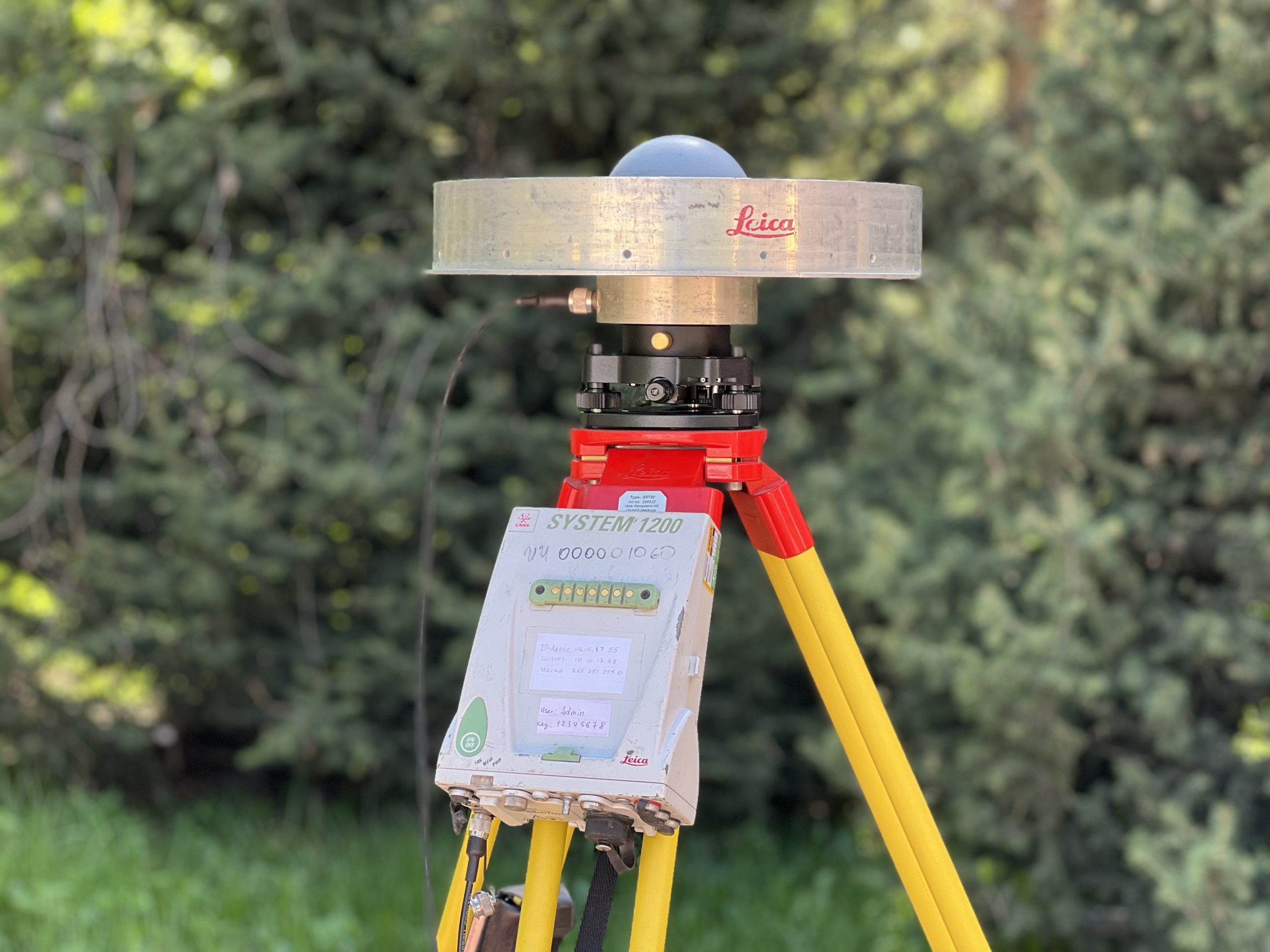
Spectra Precision SP90m
The Spectra Precision SP90m is a professional multi-frequency GNSS receiver designed for high-precision satellite geodetic observations. The equipment is used to determine the coordinates of geodetic points, conduct static and kinematic GNSS measurements, and collect satellite data for subsequent scientific processing.
At the Institute of Ionosphere, this receiver is used in satellite geodesy, geodynamic monitoring, the study of contemporary crustal movements, and the development of reference geodetic networks. The receiver can be utilized in field expeditions, operated as a base station, and deployed for observations at geodynamic test site stations.
This equipment belongs to professional-grade modular GNSS receivers and supports operation with modern satellite navigation systems. According to the manufacturer's technical specifications, the SP90m is equipped with a 480-channel GNSS ASIC, Z-Blade technology, and dual GNSS antenna inputs. These features enable the receiver to be used for a wide range of scientific, engineering-geodetic, and monitoring tasks.
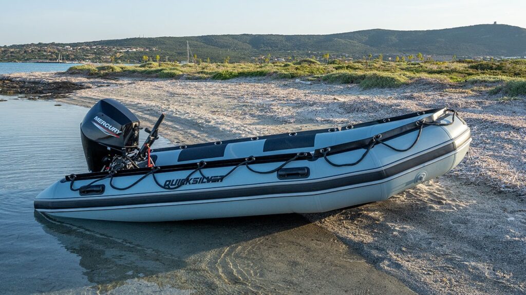
An inflatable motorboat with an outboard motor
The Quicksilver 365 SPORT HD, with a length of 3.65 m, paired with a Mercury ME 9.9 MH outboard motor, represents a mobile and reliable solution for conducting hydrographic, bathymetric, and field work on rivers, lakes, and reservoirs. The boat's reinforced construction, high payload capacity, and stability on the water ensure the safe operation of equipment and transport of specialists, while the powerful two-stroke motor enables efficient execution of work in difficult-to-reach and remote areas of water bodies.